Overview
The Accessible Urban Mapping project is a web application designed to improve urban mobility for people with disabilities. The goal was to develop a system that provides an interactive map showing accessible routes, adapted facilities, and real-time information about equipment status to help users navigate cities more independently.
This project was developed as part of a university course on web development and accessibility, with a focus on user research and inclusive design principles.
Goal
The primary goals behind the Accessible Urban Mapping project were to:
- Create an inclusive web application that addresses multiple types of disabilities
- Learn how to conduct comprehensive user research with target communities
- Implement accessible web design principles and standards
- Integrate multiple data sources and APIs for comprehensive accessibility information
- Develop a collaborative platform where users can contribute accessibility information
- Build a responsive mapping application using modern web technologies
Features
Developed
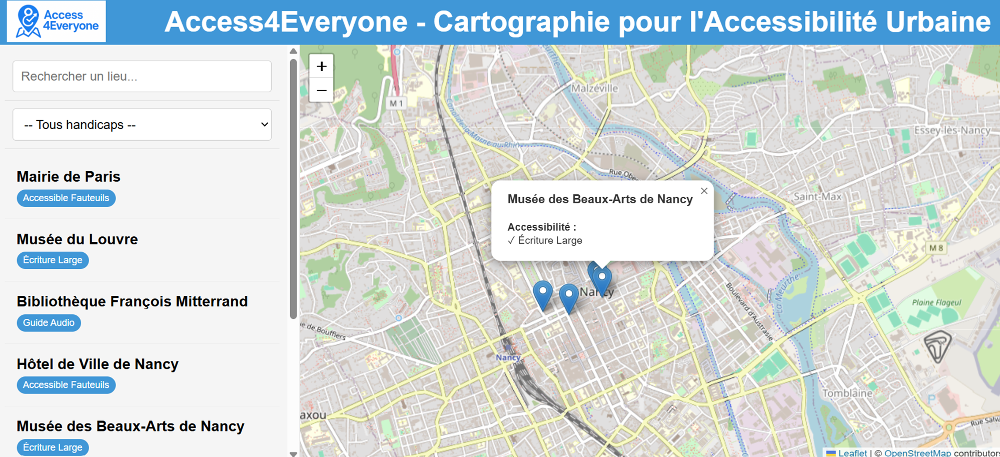
- Interactive Accessibility Map: OpenStreetMap-based interface with accessibility markers
- Multi-Disability Support: Filters and features for motor, visual, auditory, and cognitive disabilities
Thought
- Personalized User Profiles: Customizable profiles that adapt the interface and results to specific needs
- Collaborative Contribution System: User-generated content for reporting obstacles and validating accessibility
- Real-time Information: Status updates on equipment like elevators and accessible facilities
- Accessible Interface Design: WCAG-compliant design with screen reader support, high contrast options, and keyboard navigation
- Favorites and History: Personal space for saving frequently visited locations and tracking contributions
Challenges Faced
The main challenges encountered during development included:
-
User Research Complexity: Coordinating interviews with disability associations and healthcare professionals required careful planning and sensitivity.
-
Accessibility Standards: Having a deep understanding of WCAG guidelines to ensure the application itself was accessible to users with various disabilities.
-
Data Integration: Combining multiple data sources (OpenStreetMap, APIs) while maintaining data quality and consistency.
-
Multi-Disability Requirements: Designing features that work for different types of disabilities without creating a cluttered or confusing interface.
Skills Acquired
| Skills | Details |
|---|---|
| User Research & Interviews | Conducted structured interviews with people with disabilities and healthcare professionals to understand real-world needs and challenges. |
| Accessible Web Development | Learned about WCAG guidelines, screen reader compatibility, keyboard navigation, and inclusive design principles. |
| API Integration | Integrated multiple data sources including OpenStreetMap and government accessibility databases. |
| Interactive Mapping | Developed skills with Leaflet.js for creating interactive, accessible maps with custom markers and route planning. |
| Java Backend Development | Built server-side logic for data processing, user management, and API communication using Java. |
| Collaborative Development | Worked effectively in a team using Git and Trello for project management. |
| Stakeholder Communication | Maintained ongoing relationships with disability associations and healthcare professionals throughout the project. |
Conclusion
Developing the Accessible Urban Mapping application was a meaningful experience that went far beyond technical learning. The user research phase, including interviews with people with disabilities and healthcare professionals, provided valuable insights into real-world accessibility challenges that are often overlooked in traditional development projects.
The project highlighted the critical importance of involving target users throughout the development process. The feedback from the LADAPT association and the EVASION group revealed numerous unexpected obstacles and needs, from narrow elevator doors to the impact of cobblestone streets on wheelchair users.
From a technical perspective, creating an interface that works seamlessly for users with visual, motor, auditory, and cognitive disabilities requires careful attention to detail and a deep understanding of assistive technologies.
This project has significantly enhanced my understanding of accessibility, user-centered design, and the responsibility that comes with developing applications for vulnerable populations. The skills acquired are directly applicable to creating more inclusive digital experiences across all types of applications.